GeoShot Technologies is a leader in advanced Graphic Design Service, GIS, CAD, and 3D Map Illustration solutions. Since our inception in 2013, we've been committed to revolutionizing how visual experiences are crafted, transforming complex data into meaningful visual narratives.
Our journey began with a strong foundation in CAD Specialists services and GIS mapping, catering to industries requiring high-precision designs. As technology evolved, so did our expertise. We expanded into the dynamic fields of Map Illustrations and Graphic Design Service, offering state-of-the-art visual solutions for clients worldwide.
Today, GeoShot Technologies is a multifaceted company at the forefront of innovation. Our team consists of experienced professionals, including Graphics Specialists, 3D Animation Experts, GIS/LiDAR Specialists, CAD Specialists, and Scale Modelers, who collaborate to push the boundaries of advanced digital visualization.
We believe in harnessing technology to redefine digital visualization, providing stunning and precise imagery for a variety of industries. Whether it's through detailed CAD drafting, interactive map illustrations, or high-quality graphic designs, we strive to exceed client expectations and create visually compelling narratives.
As pioneers in Geospatial Services, we specialize in GIS Data Processing, LiDAR Data Processing, and UAV Data Processing. With cutting-edge technology and analytics, we transform raw spatial data into actionable insights.
Our services include:
These services empower our clients to make informed decisions based on spatial data intelligence, helping industries such as real estate, urban planning, and environmental management optimize their operations.
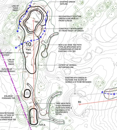
Our CAD Drafting Services cater to a wide range of industries, including golf course architects, landscape designers, and developers who require precision in their designs.
Our services include:
By utilizing advanced CAD software and industry best practices, our CAD Specialists provide detailed and precise designs that bring visions to life.
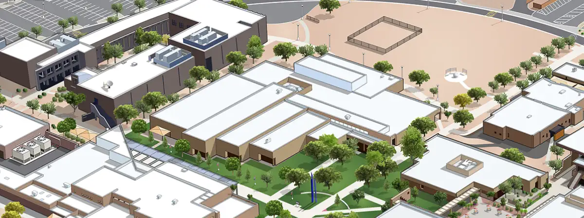
Our 3D Map Illustration services blend creativity with technical expertise, offering visually compelling maps that serve various purposes, from navigation to marketing.
Our services include:
With a keen eye for detail and a deep understanding of cartographic principles, we ensure that every 3D Map Illustration produced is both aesthetically pleasing and functionally effective.
At GeoShot Technologies, great design is at the heart of effective communication. Our Graphic Design Service encompasses a broad spectrum of creative solutions to help businesses enhance their brand presence.
Our services include:
By combining creativity with strategic thinking, our Graphic Design Service ensures that businesses communicate their message effectively and leave a lasting impact on their target audience.
With over a decade of experience in CAD, GIS, 3D Map Illustration, and Graphic Design Service, we have worked with clients across industries, delivering top-notch solutions tailored to their needs.
We leverage the latest technology in GIS, CAD, LiDAR, and 3D Map Illustration to provide innovative visualization solutions that drive results.
Serving clients across Asia, Europe, North America, and Australia, GeoShot Technologies is recognized for its high-quality output and on-time project delivery.
Every project is unique, and we take a customized approach to ensure that our solutions align with the specific requirements of our clients.
Our dedication to excellence and attention to detail ensure that we consistently exceed client expectations with every project we undertake.